
Sardinia
Sardinia, Granite Coastlines and Open Mediterranean Space
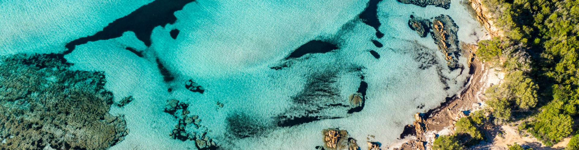
Seen from the sea, Sardinia feels expansive and sculpted. Granite headlands rise above intensely clear water, long beaches alternate with compact coves, and large stretches of coastline remain visually intact. Unlike smaller island systems, Sardinia offers scale. Routes extend across hundreds of miles, yet many anchorages remain within short reach of one another.
Situated in the heart of the western Mediterranean, Sardinia is shaped by wind as much as by geology. The mistral defines much of its coastal character, smoothing rock formations and influencing daily navigation patterns. The island’s low population density and controlled development preserve a strong relationship between landscape and sea.
From the northeast to the southwest, Sardinia changes tone without losing coherence. The Costa Smeralda presents polished harbors and emerald water, while the La Maddalena Archipelago offers protected passages and marine reserves. Further south and west, the coast becomes more rugged and remote, with longer distances between settlements.
Why choose Sardinia for sailing?
Because it combines clarity and scale. It allows for both compact island hopping and extended coastal cruising, within a landscape that remains structurally dominant over infrastructure.


Sailing Sardinia, From Protected Archipelagos to Wild Coastlines
Sailing in Sardinia adapts clearly by region. In the northeast, the La Maddalena Archipelago forms one of the Mediterranean’s most navigable protected systems. Short legs, transparent water, and granite islets create routes that are visually striking yet manageable. Anchorages are numerous but regulated within the marine park, requiring attention to designated zones.
Along the Costa Smeralda, sailing becomes more social. Harbors and well-equipped marinas contrast with secluded calas only a few miles away. The balance between services and natural stops makes this region accessible to a wide range of sailors.
Moving south along the eastern coast introduces longer distances and deeper bays, with fewer concentrated tourist centers. The western coast becomes more exposed, shaped by mistral winds and open horizons. Here, passages feel more substantial and less enclosed.
Is Sardinia suitable for beginners?
Yes, particularly in protected areas like La Maddalena. At the same time, experienced sailors can explore more exposed stretches and longer coastal legs. Catamarans and monohulls are both common, and routes can be scaled according to wind forecasts and experience. IntersailClub typically approaches Sardinia modularly, selecting regions that align with desired pace and exposure.
In Sardinia, sailing is not limited to one pattern. It expands with geography.


Nuragic Heritage and Maritime Identity
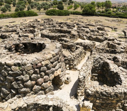
Sardinia’s cultural roots extend back to the Nuragic civilization, whose stone towers, known as nuraghi, still dot the landscape. While many are inland, their presence reflects an ancient society that understood both land and sea.
Throughout history, Sardinia was influenced by Phoenician, Roman, Spanish, and Italian powers. Coastal towns developed as trade points and defensive positions, yet large sections of coastline remained sparsely settled. This duality persists today, where lively ports coexist with long, uninhabited stretches of shore.
Fishing traditions remain active, particularly in smaller towns. Local cuisine emphasizes seafood, bottarga, and regional produce, maintaining a direct link to marine cycles.
What defines Sardinia’s identity?
Autonomy shaped by geography. The island’s size and relative isolation fostered a distinct cultural character that remains visible in language, architecture, and daily rhythms.
Approaching Sardinia by sea clarifies its structure. Settlements align with natural shelter, and much of the coastline appears unchanged by large-scale construction.
Sardinia does not compress its identity into a single coastline. It distributes it across distances.
Climate and Sailing Conditions in Sardinia
June is the hottest month in Havana with an average temperature of 27°C (81°F) and the coldest is January at 21°C (70°F) with the most daily sunshine hours at 11 in July. The wettest month is June with an average of 80mm of rain. The best month to swim in the sea is in August when the average sea temperature is 30°C (86°F).
Check all Statistics in AccuweatherAll destinations in Mediterranean Sea
-

-
-
-
-
-
-
-
-
-
-
-
-
-
-
-
-
-
-
-
-
-
-
-
-
-
-
-
-
-
-


