Capri
Capri, A Limestone Island Rising from the Tyrrhenian Sea
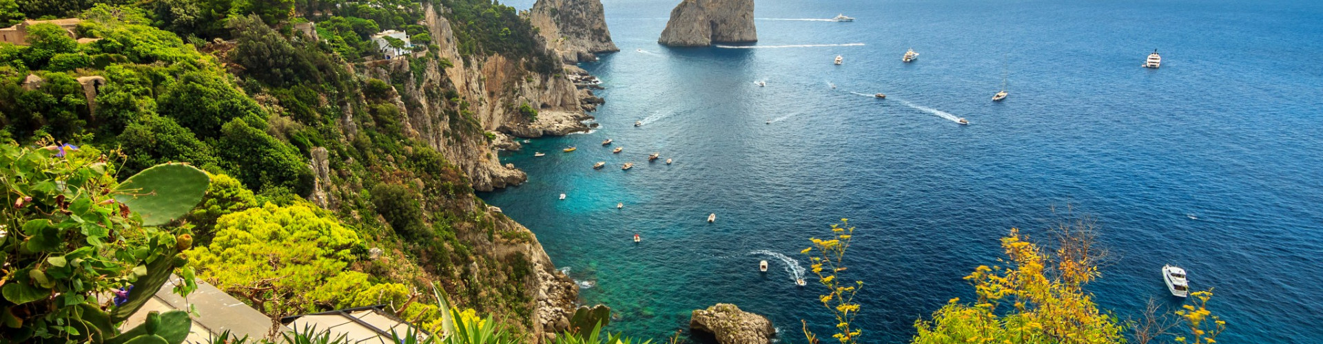
Seen from the water, Capri announces itself with clarity. Pale limestone walls rise abruptly from deep blue, punctuated by arches, caves, and vertical faces that catch and reflect light throughout the day. Unlike islands defined by beaches or low horizons, Capri is immediately legible as a solid mass, compact, steep, and unmistakably maritime.
Capri lies at the entrance of the Gulf of Naples, just off the Sorrentine Peninsula, positioned between the mainland and the open Tyrrhenian Sea. Its location has made it both accessible and distinct. Close enough to be reached quickly, yet separated by water that reinforces its identity, Capri has long been perceived as a place apart. Inland, the island climbs rapidly toward Monte Solaro, its highest point, while the coastline offers few gradual transitions between land and sea.
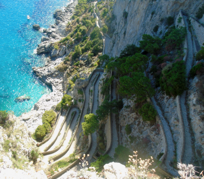
Historically, this geography limited large-scale development. Settlements such as Capri town and Anacapri grew above the waterline, connected to the coast by steep paths and later by roads. Harbors remain small and functional, emphasizing access rather than expansion. The absence of extensive beaches or flat land shaped an identity based on views, light, and elevation rather than sprawl.
Why visit Capri beyond its reputation?
Because its appeal lies in structure, not scale. The island’s beauty is concentrated, architectural, and defined by contrast between solid rock and open water. Approaching slowly from the sea, Capri reads as a sculpted object rather than a resort destination, revealing details that are easy to miss from land.


Sailing Capri, Vertical Coasts and Circular Routes
Sailing around Capri is a contained but visually rich experience. The island’s perimeter is small, allowing a full circumnavigation in a single day under favorable conditions, yet the coastline offers constant variation. Navigation is primarily coastal, with deep water close to shore and limited anchorages shaped by exposure rather than distance.
The southern side is dominated by the Faraglioni, towering rock formations that rise directly from the sea and serve as both navigational markers and defining symbols of the island. Nearby, Marina Piccola offers one of the few sheltered areas suitable for anchoring, particularly in calmer conditions. Access to shore is typically by tender, as space is limited and highly regulated.
Along the western coast, cliffs and sea caves define the route. The Blue Grotto sits at the base of a limestone wall, accessible only in calm seas and by small boats. Approaching this area by sail provides a clearer sense of how wave, rock, and light interact, shaping the island’s most famous natural features.
Is Capri good for sailing?
Yes, but not for those seeking remote anchorages or extended passages. Sailing here is about proximity, timing, and awareness of traffic. The island is busy during peak season, and local regulations influence where and how boats can stop. Catamarans and skippered cruises are common, as maneuverability and local knowledge are essential. IntersailClub typically frames Capri as part of a wider itinerary rather than a standalone destination, often combined with the Amalfi Coast or the Sorrentine Peninsula to balance intensity and space.
Sailing around Capri does not extend distance. It deepens perspective, offering angles and light conditions that reveal the island’s structure more clearly than any viewpoint ashore.


Layers of History on a Compact Island
Capri’s cultural identity has always been shaped by its visibility. In Roman times, emperors such as Tiberius chose the island as a retreat, building villas along the cliffs to command views of sea routes below. Remains of these structures still overlook the water, reinforcing the island’s long association with observation and control rather than isolation.
Following antiquity, Capri returned to a quieter rhythm, its population relying on fishing, small-scale agriculture, and limited maritime trade. The island’s steep terrain discouraged expansion, preserving a compact settlement pattern that endured into the modern era. In the 19th and early 20th centuries, Capri attracted writers, artists, and travelers drawn by its light and sense of enclosure, gradually building an international reputation.
What cultural influences shape Capri today?
Layering rather than replacement. Roman heritage, rural traditions from Anacapri, and modern cosmopolitan life coexist within a confined space. Religious festivals, small markets, and everyday routines continue alongside global tourism, often separated by altitude and access rather than distance.
Sailing reinforces this layered understanding. From the sea, ancient villa sites, watchpoints, and modern marinas align along the same coast, revealing continuity in how the island has been used and perceived over time.
Capri’s culture is not expansive. It is condensed, shaped by centuries of looking outward from a small but strategic island.
Climate and Sailing Conditions Around Capri
June is the hottest month in Havana with an average temperature of 27°C (81°F) and the coldest is January at 21°C (70°F) with the most daily sunshine hours at 11 in July. The wettest month is June with an average of 80mm of rain. The best month to swim in the sea is in August when the average sea temperature is 30°C (86°F).
Check all Statistics in AccuweatherDec
Jan
Feb
Mar
Apr
May
Jun
Jul
Aug
Sep
Oct
Nov
All destinations in Mediterranean Sea
-

-
-
-
-
-
-
-
-
-
-
-
-
-
-
-
-
-
-
-
-
-
-
-
-
-
-
-
-
-
-


